Reflections on the EAA 2013 Roundtable on “Ephemeral Landscapes”

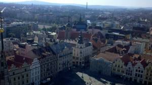
pilznIn September, the European Association of Archaeologists (EAA) held its meetings in Pilsen, Czech Republic.  I attended this meeting, and participated in a roundtable on ‘Ephemeral Landscapes,’ organized by Martijn vanLeusen, Andrew Bevan, Kayt Armstrong, and Wieke deNeef.  The workshop was well attended, and a lively discussion was held on the state of landscape archaeology and geospatial applications.  As we are on the cusp of the AIA meetings in Chicago, I present my thoughts and general takeaways.  These are my own ideas/impressions and I am not representing anyone but myself in these thoughts.

The following papers were presented:

The excavation of a hunting thicket in Roissy (France)
by Jean-Yves Dufour (INRAP, France)

Minor and off-sites: the Pisa South Picenum Project  (The Marches, Italy)
by Simonetta Menchelli (University of Pisa, Italy), Marinella Pasquinucci (University of Pisa, Italy)

The detection of rural activity patterns through intensive archaeological survey. Some experiences form south-west Iberia
by Luis Sevillano Perea (Merida Institute of Archaeology, Spanish Research Council (CSIC), Spain), Victorino Mayoral Herrera (Merida Institute of Archaeology, Spanish Research Council (CSIC), Spain)

The intersection of theory and practice in “marginal” mountainous landscapes: the investigation of past human-environment interactions in the southwestern Alps
by Kevin Walsh (University of York, UK), Francesco Carrer (University of York, UK),Florence Mocci (CNRS, France)

Laying bare the landscape: large-scale rural archaeology in the upper Thames valley, England
by Roger M Thomas (English Heritage, UK), Chris Gosden (University of Oxford, UK),Morrison Wendy (University of Oxford, UK)

Developing interpretative frameworks for ephemeral artifact scatters: a geoinformatic example from central Turkey
by James Newhard (College of Charleston, USA)

Uncertainty and persistence: rural signatures and archaeological survey
by Andrew Bevan (University College London, UK)

During and after, there was quite a bit of discussion between the audience and speakers, bringing out several themes in my mind.  Some of these I see as providing interesting and fruitful areas for concerted attention, others are time-worn issues that seem in no real way currently solvable (if they even need solving).

Data interoperability.  Work from the Upper Thames brought this point to light.  In this region, Thomas noted the wide variety of projects and studies, initiated over a span of decades, and the complexity that arises from the perspective of data mining.  It is in no way an isolated case.  Developing systems for integrating divergent studies is an imperative – especially for areas where there is intensive activity from multiple entities.  The conversation moved into discussing ways in which methods could be streamlined.  On one level, this is a valid discussion.  On another, I feel the need for caution.  If we focus excessively on streamlining methods, we enter into a morass where people start championing specific approaches and run the risk of stifling innovation in method and the exploration of new avenues of investigation.  Another point against methodological standardization is the fact that this is a field of already tremendously deep datasets – how would earlier projects be integrated?

Rather, systems of integration should be pursued that are able to lay over individualistic approaches.  Geospatial applications, with their capacity to statistically smooth divergent datasets, may be an area where these systems can be best developed.  As opposed to thinking of methods standardization that could run the risk of standardizing research questions and ignoring local needs (whether dependent upon terrain, material, or legal strictures), I would suggest looking towards the idea of data standardization.  The issue then becomes a matter of statistical standardization, a matter that is not unique to archaeology, and for which there may be solutions residing in other disciplines such as biology, geology, sociology, to name a few.

Ethnographic and historical analogs.  The use of historical or ethnographic analogy was often addressed in the papers (Menchelli, Newhard) and within the ensuing discussion.  The overriding consensus appeared that analogs should not be used as strict proxies, but rather as guides for developing further questions, and possibly tipping the balance towards one interpretation over another (barring other evidence to the contrary).

Greater rigor in assigning functional attributes.  In this area, we are starting to see some movement.  There are beginnings of stating some criteria, and then assigning function based upon those stated criteria.  We’ve been doing this for some time, but the definitions have been very generalized (it’s a biggish spread of pottery, must have been a farm house…).  The capacity to integrate geospatial elements is yielding new developments in making these criteria more complex and explicit.  We’re moving from a practice of inductiveness to deductiveness, which should yield opportunities in the future for stronger systems of data collection and analysis.  We need not concern ourselves with offering explanations for every observed piece of antique detritus, but be intent upon describing and assigning function to as much as possible, with an explicit argument stated for those assignments.

Lack of theoretical approaches.  Within the presentations – and even continuing into the discussions – there was a general lack of theoretical paradigms.  Despite this, there was in the air scents of several broad approaches.  Speaking generally, there was a close cultural historical approach (Tiber), the more positivistic/quantitative approach (Spain, Calabria, Antikythera), and more reflexive, open perspective (Turkey- although still highly positivistic/quantitative).  Phenomenological contexts appeared least represented, although such approaches would have been possible.  Although theory and method cannot be separated, in my opinion, the subject of the workshop was methodologically focused, leading to a lessened focus upon theoretical approaches.

Geospatial applications.  Underlying most, if not all, of these issues is the need for an extensive application of GIS and other spatial applications.  Data interoperability and functional modeling, in particular, are issues where intensive use of geospatial applications are inherently required, and should be included within the basic toolkit of any person involved in the practice of landscape archaeology.

Overall, I view efforts to consolidate methods to be a red herring that would move us away from more effective contributions.  A sense of best practices have generally been in place since the days of Plog, Plog, and Wait (if not earlier), and what we should be encouraged is refinement and development of technological tools and analytical techniques that build upon the general methods of the past.  Areas of growth reside in the areas of data interoperability and developing/encouraging systems that seek to describe and explain archaeological signatures in a structured and systemic fashion, with an eye towards allowing a variety of theoretical approaches to be brought to bear on the data.

Posted in Academia, Conferences, State of the Field | Tagged , , , , | Leave a comment

3D Archaeology at Çatalhöyük

3D Thursday!

Archaeology of the Mediterranean World

 This is the twelfth in a series of posts exploring 3D modeling in Mediterranean and European archaeology. For more in this series click here. We hope these papers will start a discussion either in the comments of the blog or on Twitter using the #3DMedArch hashtag. 

3DThrusday

Maurizio Forte, Duke University

Introduction

Digital documentation and visualization in archaeology include digital applications of computer graphic rendering and simulation involving data, models and spatial information produced by different integrated technologies of data capturing, virtual reconstruction and visual communication (Forte 2010; Forte and Kurillo 2010; Forte and Siliotti 1997; Forte 2012). In the last decade the use of digital technologies on archaeological sites has exponentially grown at different scales and for different purposes: GIS, mapping, 3D modeling, remote sensing applications and digital photogrammetry. A really revolutionary approach in the archaeological documentation (on and off site) has been the introduction of image…

View original post 3,301 more words

Posted in Uncategorized | Leave a comment

3D Reconstruction of the Renaissance Bastion of the Langenbrücker Gate in Lemgo (Germany)

3D Thursday!

Archaeology of the Mediterranean World

This is the eleventh in a series of posts exploring 3D modeling in Mediterranean and European archaeology. For more in this series click here. We hope these papers will start a discussion either in the comments of the blog or on Twitter using the #3DMedArch hashtag.

Guido Nockemann, Freelance Archaeologist, AMD Nockemann,

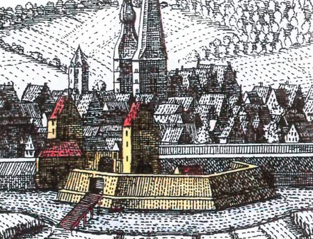
In the beginning of the 16th century up until the Thirty Years War, the city of Lemgo was turned into a Renaissance fortress with a rampart, trench and bastions – unfortunately it was never finished. The southern entrance to the city was a bastion bathed by the river Bega with an associated gate construction with rampart and outer bailey on the city side (fig. 1).

Pic 1 LennepstichFigure 1: The Langenbrücker gate on a copperplate print of Elias and Henry van Lennep, about 1663

During archaeological excavations from 2009 to 2011 in preparation for constructions of the Langenbrücker Gate, remains…

View original post 560 more words

Posted in Uncategorized | Leave a comment

The Work of Archaeology in the Age of Digital Surrogacy

3D Thursday!

Archaeology of the Mediterranean World

This is the tenth in a series of posts exploring 3D modeling in Mediterranean and European archaeology. For more in this series click here. We hope these papers will start a discussion either in the comments of the blog or on Twitter using the #3DMedArch hashtag.

Adam Rabinowitz, The University of Texas at Austin

I’m very glad that Bill has run this series of 3D Thursday blog posts, because they have demonstrated with particular clarity that field archaeology is at a turning-point in its engagement with three-dimensional visualization. A decade ago, a series of posts on 3D technologies in archaeology would have been concerned mainly with computer-aided virtual reconstructions and immersive environments or with the use of laser scanners. This series, however, has highlighted an emerging common interest in the use of computational photography to create photorealistic 3D representations of archaeological material. 

3DThrusday

Previous posts have emphasized the way new…

View original post 4,141 more words

Posted in Uncategorized | Leave a comment

Acropolis Museum on Google Maps

res gerendae

I’m not sure when this went up on the internet, but no one has pointed it out to me before, and so therefore I offer you the following post.  I just discovered that the Acropolis Museum in Athens is featured in the Google Cultural Institute (a division of Google of which I was hitherto unaware), and it has a page where there is featured selection of various artefacts in its holding, so details of the gods on the East Parthenon Frieze, the Antenor Kore, the Moschophoros, various decrees, and so forth.   That is all fun and good, but if you click on the little yellow man by the words Acropolis Museum you can actually view the inside the museum in Google Maps with 360º rotating views, including a full walkabout of the Parthenon frieze and the gallery of sculpture on the first floor.

Need to see the whole…

View original post 49 more words

Posted in Uncategorized | 1 Comment

Three- and Four-Dimensional Archaeological Publication

3D Thursday!

Archaeology of the Mediterranean World

This is the ninth in a series of posts exploring 3D modeling in Mediterranean and European archaeology. For more in this series click here. We hope these papers will start a discussion either in the comments of the blog or on Twitter using the #3DMedArch hashtag.

Andrew Reinhard, Director of Publications, American School of Classical Studies at Athens

I have been the Director of Publications for the American School of Classical Studies at Athens (ASCSA) for just over three years, and am responsible for publishing our quarterly journal, Hesperia, as well as excavation monographs for Ancient Corinth, the Athenian Agora, and affiliated sites, plus Hesperia Supplements on special archaeological topics, as well as guidebooks and limited series. The views that I express in this post are my own, but it is my hope that various, official ASCSA boards and committees will agree with me on at least some of…

View original post 2,861 more words

Posted in Uncategorized | Leave a comment

3D Imaging in Mediterranean Archaeology: What are we doing, anyway?

3D Thursdays!

Archaeology of the Mediterranean World

This is the eighth in a series of posts exploring 3D modeling in Mediterranean and European archaeology. For more on this project click here. We hope these papers will start a discussion either in the comments of the blog or on Twitter using the #3DMedArch hashtag.

James Newhard, Associate Professor, Department of Classics, College of Charleston

I come to the topic of 3D imagery from the perspective largely of the ‘end user.’ While I’m involved with projects that are capturing and using 3D imagery (such as the Palace of Nestor Linear B project), my expertise does not lie in this area. As such, my perspective and contributions lie on the level of one who sees 3D imagery largely in the context of its use, and in the broader context of digital applications in archaeology.

3DThrusday

To be fair, I have a notorious quirk. I can overlook easily the next…

View original post 1,700 more words

Posted in Uncategorized | Leave a comment

Hestia2 in Stanford: visualising complex data

Archaeological Networks

Hestia_logo_whtRemember the Hestia2 event we organised in Southampton in July with The Connected Past? Time for more of that! The Hestia project is pleased to announce its second community event, which will take place at Stanford University on 4-5 November 2013. The two-day workshop, hosted by Stanford’s Center for Spatial and Textual Analysis, will tackle the issue of visualizing complex data, and will be of interest to anyone working on network theory and the digital analysis of literature and historical material.

It will include presentations from various local high-tech companies developing complex data analysis and hands-on work with the following humanities projects based in Stanford:
Orbis 2.0, the latest geospatial network model of the ancient world;
Arches, a new open-source geospatial software system for cultural heritage inventory and management;
– Palladio, a new platform for visualizing and analyzing networks of historical data;
– Topotime, a…

View original post 74 more words

Posted in Uncategorized | Leave a comment

Photogrammetry on the Pompeii Quadriporticus Project

Archaeology of the Mediterranean World

This is the seventh in a series of posts exploring 3D modeling in Mediterranean and European archaeology. For more on this project click here. We hope these papers will start a discussion either in the comments of the blog or on Twitter using the #3DMedArch hashtag.

Eric Poehler, Assistant Professor, Department of Classics, University of Massachusetts, Amherst. 

3DThrusday

Since the inception of the Pompeii Quadriporticus Project in 2010, my co-director Steven Ellis and I have been exploring the use of photogrammetry to document one of the largest monumental structures at Pompeii as part of a comprehensive digital approach to the archaeological and architectural study of this building. Our approach has attempted to integrate photogrammetry with other imaging methods, including laser scanning and ground penetrating RADAR, as well as more traditional fieldwork digital products, such as standard photography, layered vector drawings, Harris matrices, and database records. The role that photogrammetry…

View original post 3,024 more words

Posted in Uncategorized | Leave a comment

Gizmodo Features Archaeology

Gizmodo.com is taking the opportunity of International Archaeology Day to write about the use of technology in archaeology:

Geoff Manaugh:  The Technology of Archaeology

Kelsey Cambell-Dollaghan:  “The Streets Are Hollow”: What’s It Like to Be an Archaeologist in NYC?

Geoff Manaugh:  Laser-Scanning Hundreds of Artificial Caves Beneath Nottingham

Robert Sorokanich:  Lasers, Drones, and Future Tech on the Front Lines of Archaeology

Geoff Manaugh:  Drone Mapping Lost Pyramids in the Andes

Jordan Kushins: Beneath the Streets, Lost Cities

Jaime Condliffe: CyArk Wants to Digitally Preserve 500 Heritage Sites In Just Five Years

Posted in State of the Field | Leave a comment